The MGI Team and the Municipality of Piura Participated
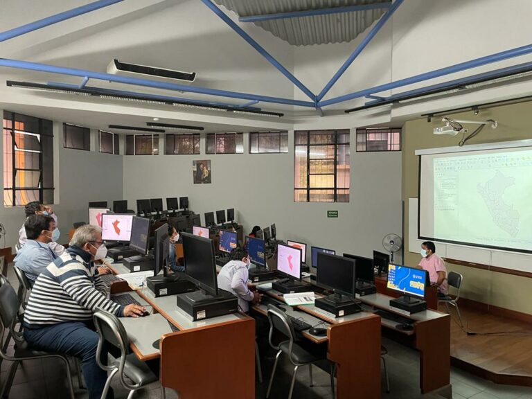
In May 2022, the local team and officials of the municipality of Piura received a total of 36 hours of software training on the GIS (Geographic Information Systems) tools QGIS and CARTO. The local actors will use these tools for the implementation of the pilot project.
The Training Objective

The training was divided into two parts. During the week of May 9th to 14th, training sessions were held on QGIS software with a total of 20 hours. QGIS is a free software that allows data analysis at an urban scale. From May 24th to 27th, a map workshop with a total of 16 hours using CARTO took place. CARTO is a cloud-based software that allows creating interactive maps and making calculations with the imported data.
The objective of the training was to provide important knowledge on the use of the software tools to the local actors for different stage of the project. For instance, the MGI Piura team will use GIS and CARTO to develop a methodology for selecting the intervention site for the pilot project implementation. After the implementation, municipal officials will continue updating the data to intervene in more sites in the city.
The Pilot Project in Piura
The pilot project selected for implementation consists in eliminating illegal dumpsites around the city of Piura through community intervention. Afterwards, the sites are planned to be converted into public green and recreational spaces.
Next Steps
The next steps in the pilot project lead to the selection of the implementation site using the GIS tools. First, critical points for intervention are selected based on the methodology designed by the MGI team. Then, a manual on the software tools is to be prepared for future use. Last, intervention sites are prioritized and discussed among all local stakeholders before designating a space as a pilot.
Find more information on Piura and MGI’s work in the city here.

